
Page 38 - PDI_Report
P. 38
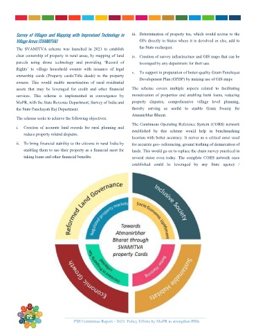
Survey  of  Villages  and  Mapping  with  Improvised  Technology  in   iii.  Determination of property tax, which would accrue to the
         Village Areas (SVAMITVA)                                   GPs directly in States where it is devolved or else, add to

         The  SVAMITVA  scheme  was  launched  in  2021  to  establish   the State exchequer.
         clear ownership of property in rural areas, by mapping of land   iv.  Creation of survey infrastructure and GIS maps that can be
         parcels  using  drone  technology  and  providing  ‘Record  of   leveraged by any department for their use.
         Rights’  to  village  household  owners  with  issuance  of  legal
                                                                v.  To support in preparation of better-quality Gram Panchayat
         ownership  cards  (Property  cards/Title  deeds)  to  the  property
                                                                    Development Plan (GPDP) by making use of GIS maps
         owners.  This  would  enable  monetization  of  rural  residential
         assets  that  may  be  leveraged  for  credit  and  other  financial   The  scheme  covers  multiple  aspects  related  to  facilitating
         services.  This  scheme  is  implemented  in  convergence  by   monetization  of  properties  and  enabling  bank  loans,  reducing
         MoPR, with the State Revenue Department, Survey of India and   property  disputes,  comprehensive  village  level  planning,
         the State Panchayati Raj Department.                   thereby  serving  as  useful  to  enable  Gram  Swaraj  for
                                                                Atmanirbhar Bharat.
         The scheme seeks to achieve the following objectives:
                                                                The Continuous Operating Reference System (CORS) network
         i.   Creation  of  accurate  land  records  for  rural  planning  and
                                                                established  by  this  scheme  would  help  in  benchmarking
            reduce property related disputes.
                                                                location with better accuracy. It serves as a critical asset used
         ii.  To bring financial stability to the citizens in rural India by   for accurate geo- referencing, ground truthing of demarcation of
            enabling them to use their property as a financial asset for   lands. This would go on to replace the chain survey practiced in
            taking loans and other financial benefits.          several  states  even  today.  The  complete  CORS  network  once
                                                                established  could  be  leveraged  by  any  State  agency  /


             12
                                    PDI Committee Report - 2023: Policy Efforts by MoPR to strengthen PRIs         12